Punta Manara hike – What a wonderful walk!
✅ Before starting with Punta Manara hike, here are some really interesting links about Sestri Levante and Tigullio. Take a look! 😉
- Sestri Levante: what to see?
- Tigullio’s treasures you cannot miss: The Christ of the Abyss
- San Michele di Pagana: what to see?
- Tigullio: 5 Things you can’t miss!
- 5 things to see in Santa Margherita Ligure!
- Tigullio: 10 (and more) reason for a Winter visit
- Tigullio: 5 curious things you need to know!
- Love in Portofino: the very original song

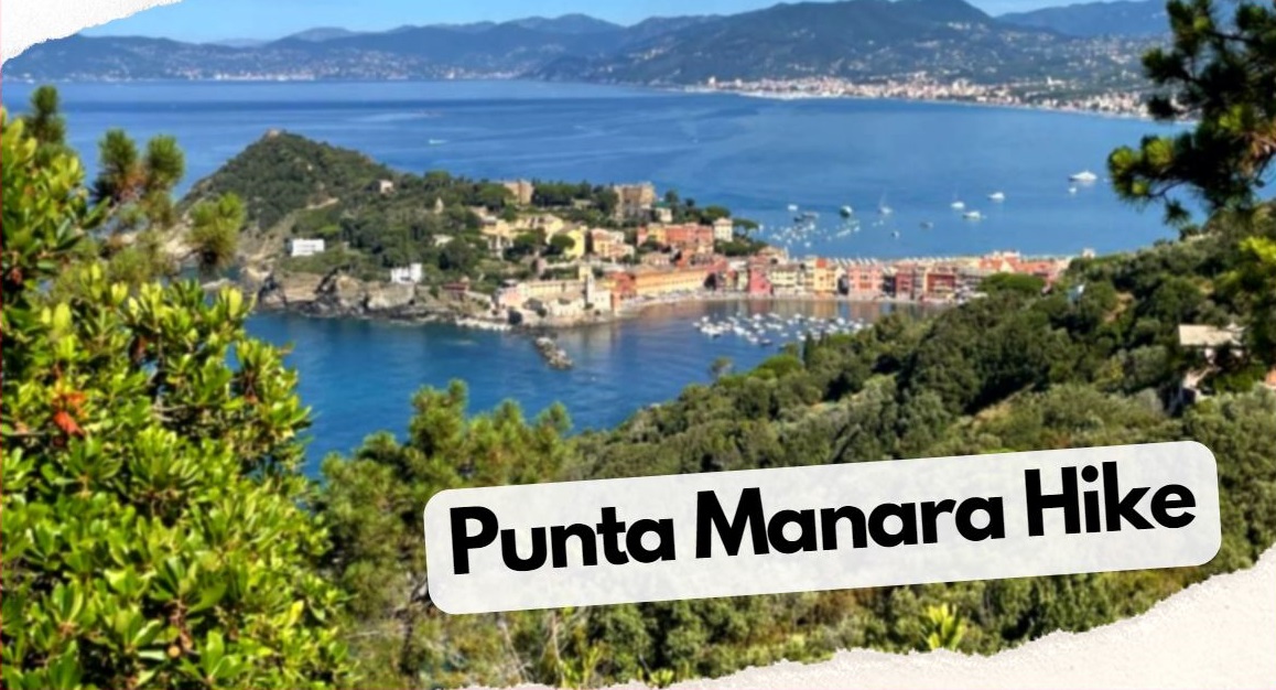
Punta Manara is a triangular-shaped promontory extending into the Gulf of Tigullio, which extends between the Ligurian towns of Sestri Levante and Riva Trigoso.
The Punta Manara hike is one of the most beautiful and appreciated excursions by visitors of the Tigullio Gulf.
Located at the extreme west of the Gulf, Punta Manara offers extraordinary views of the coast and it is possible to admire many animal and plant species that inhabit the local Mediterranean scrub.
It has an area of about 190 hectares, of which about 50 are entirely occupied by holm oak wood, while the remaining spaces are divided between Mediterranean scrub (holm oak, strawberry tree, heather) and a small strip of cork oak.

The largest plant population is represented by the maritime pine, which covers the maximum altitude of the promontory.
Are still visible the ruins of an ancient fortress and a more recent one, used by the Territorial Militia and by the Germans, during the Second World War.
Take also a look at: Sestri Levante: what to see?
Punta Manara: how to get there
Punta Manara can be reached only on foot, through the paths above Sestri Levante.

A path starts right from the alleys – ascent of the Mandrella – of the historic center of Sestri Levante.
After a series of steps that lead you up, out of the town, begins an almost flat walk in the typical Ligurian vegetation.
Once in Punta Manara, you can choose to continue the path and 🔽 go down to Riva Trigoso, through a steeper walk that crosses fields of gorse and vegetable gardens.

The so-called Nature Trail is signposted on the promontory and constitutes an excursion itinerary of rare beauty in the Ligurian natural landscape.
Furthermore, a part of the path is used as a botanical path with illustrative signs describing the plant species encountered along the way.
Take also a look at: Tigullio: 5 Things you can’t miss!
The trails of the Punta Manara promontory are all in medium difficulty and equipped with benches and rest areas.
To walk in them, is necessary to follow the rules and behavior of excursion tourism in protected natural areas.

Wear suitable shoes and bring the necessary water supplies: there are no sources of drinking water along the paths.
Take also a look at: Chiavari what to see? Full tutorial
Punta Manara hike – the Monte Castello
On the top of Monte Castello (266 meters) and in other areas, there are rest places for groups, with wooden tables and benches.

The Promontory of Punta Manara is crossed by over 10 km of paths, which cross unique natural environments, protected by the European Habitats Directive, belonging to the Natura 2000 Network.
Along the ring path, which runs along the three sides of the promontory, there are fantastic views.
On the rugged and rocky coast that goes from Punta Mesco in the east, to the promontory of Portofino in the west side.

A characteristic of the Promontory is the vegetation variability, which includes evergreen woods such as holm oak, cork oak, Mediterranean conifers and scrub – but also deciduous woods, typical of the Apennine environments.
The fauna of the Punta Manara promontory is also varied and valuable, with both sedentary and migratory species protected at European level.
Take also a look at: Tigullio: 10 (and more) reason for a Winter visit